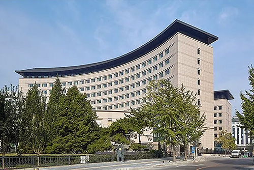
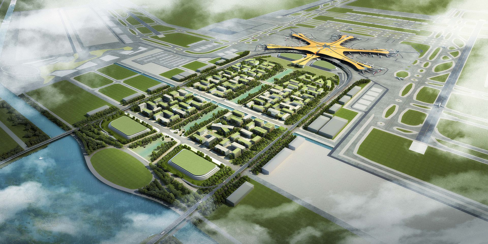
大兴国际机场控制性详细规划及城市设计,北京/规划
该项目位于北京大兴区与河北省廊坊市广阳区交界区域,是实现京津冀区域一体化融合发展的重要工程实践。规划积极贯彻建设“智慧城市”、“森林城市”、“海绵城市”。
This project is located in the border area between Daxing District, Beijing and Guangyang District, Langfang City, Hebei Province. It is an important engineering practice to achieve the integrated development of the Beijing Tianjin Hebei region. The plan actively implements the construction of "smart cities", "forest cities", and "sponge cities".
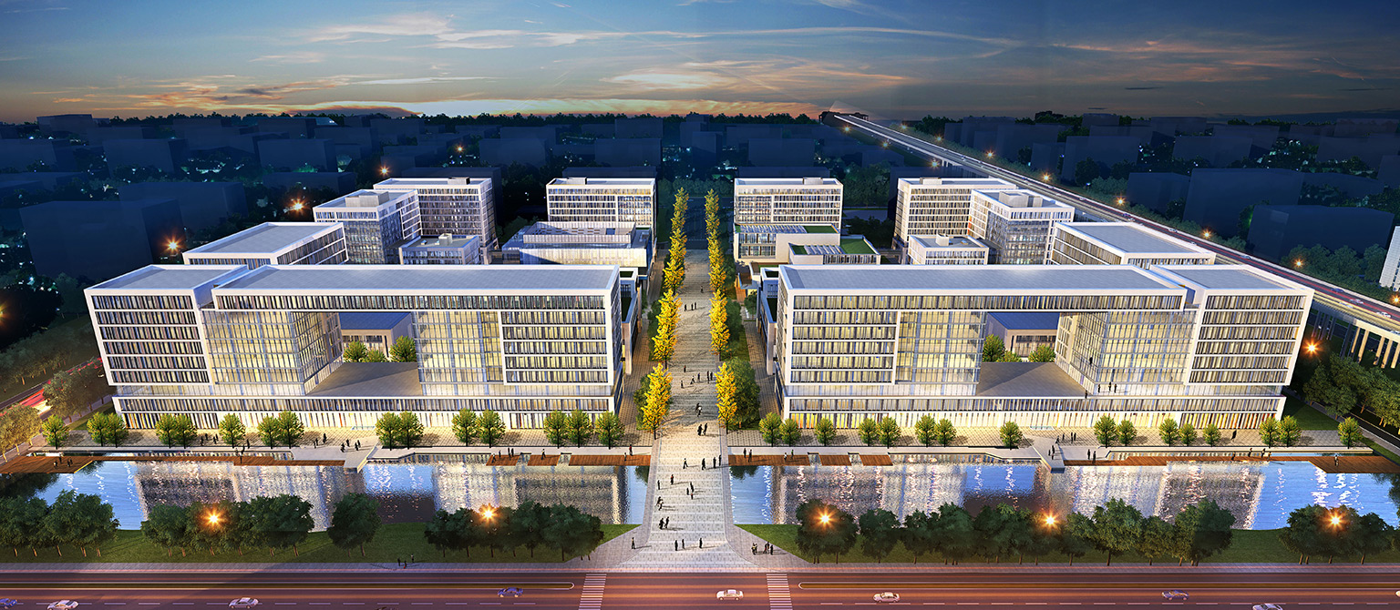
规划理念积极创新,用地功能从单一性向混合性转变,建设小尺度混合、开放街区。提出高密度路网和公交优先的交通策略。空间一体化设计与开发,有利于优化配置各类城市资源,降低开发成本。
The planning concept is actively innovative, and the land use function is shifting from single to mixed, constructing small-scale mixed and open blocks. Propose transportation strategies for high-density road networks and bus priority. The integrated design and development of space is beneficial for optimizing the allocation of various urban resources and reducing development costs.
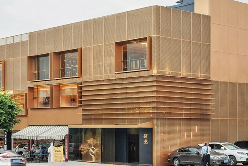
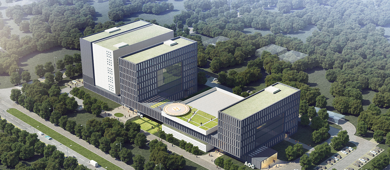
规划通过分析北京传统合院特点,采用灵活多变的建筑组合形式,形成开放、和谐的合院式空间。第五立面的整体营造策略与中央景观带的线性形态特征高度契合。规划成果将民航行业标准和城市规划要求相结合,将北京与河北省城市规划要求相结合,并将作为规范机场用地建设的指导性文件。
The plan analyzes the characteristics of traditional courtyard houses in Beijing and adopts flexible and diverse architectural combinations to form an open and harmonious courtyard style space. The overall construction strategy of the fifth facade is highly aligned with the linear morphological characteristics of the central landscape zone. The planning results will combine the civil aviation industry standards with urban planning requirements, combine the urban planning requirements of Beijing and Hebei Province, and serve as a guiding document for regulating the construction of airport land.
规划将近远期相结合,提高机场区域土地的利用效率,使机场与城市有机结合,保障机场、铁路的人流、货流运输能力和安全,做到系统清晰、运行有序、边界明确、合理分区。 规划从整体城市空间角度出发,对机场航站楼前核心区的交通流线、开放空间、整体空间形态、街区模式等进行研究,并对航站楼前的中央景观带、地下空间以及主要功能区展开专题研究。
Combining the near and long term planning to improve the efficiency of land use in the airport area, organically integrating the airport with the city, ensuring the transportation capacity and safety of the airport and railway for people and goods, and achieving a clear system, orderly operation, clear boundaries, and reasonable zoning. Starting from the perspective of overall urban space, the plan conducts research on the traffic flow, open space, overall spatial form, and block mode of the core area in front of the airport terminal, and conducts thematic research on the central landscape zone, underground space, and main functional areas in front of the terminal.
设计突破传统的控制,地下空间一体化设计与开发将街区、景观、地下空间与基础设施统筹考虑,有利于优化配置各类城市资源,营造更便捷的城市环境,降低开发成本。地下公共空间与其上方的中央景观带积极互动,从环境心理学的角度改善空间体验,并且通过雨水收集、能源中心、机动车交通入地等措施,改善整个区域的生态环境。
The design breaks through traditional control, and the integrated design and development of underground space takes into account the block, landscape, underground space, and infrastructure, which is conducive to optimizing the allocation of various urban resources, creating a more convenient urban environment, and reducing development costs. The underground public space actively interacts with the central landscape strip above it, improving the spatial experience from the perspective of environmental psychology, and improving the ecological environment of the entire region through measures such as rainwater collection, energy centers, and motor vehicle transportation.
以公交为导向的小街区模式:推行“窄马路、密路网”的路网格局,建设开放、尺度适宜的小街区,避免产生过大体量建筑。鼓励形成开放街区,争取公共、开放的空间环境。城市中街区的大小会根据其区位而变化,适应不同的交通可达、功能性质与开发强度等,以形成不同活力性质的城市中心、场所以及社区。规划根据公共交通站点布局、功能性质等,确定机场用地中心区、普通区、以及边缘区的形态分类。
The small block model guided by public transportation: promote a "narrow road, dense road network" road grid, build open and appropriately sized small blocks, and avoid the generation of oversized buildings. Encourage the formation of open neighborhoods and strive for a public and open spatial environment. The size of urban street areas will vary according to their location, adapting to different transportation accessibility, functional properties, and development intensity, in order to form urban centers, places, and communities with different vitality. According to the layout and functional properties of public transportation stations, the planning determines the morphological classification of the central area, ordinary area, and edge area of the airport land.
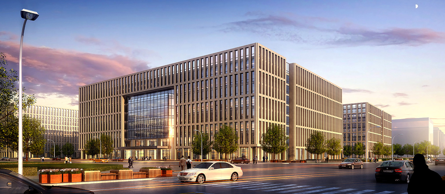
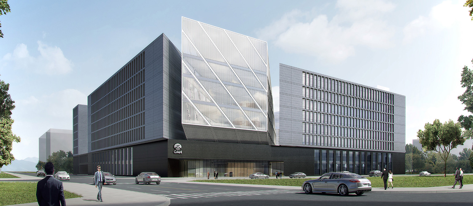
建筑形态控制:高度控制,控制建筑高度与街道宽度比。建筑高度控制需要与街道空间相协调,形成宜人的街道尺度。建筑体量控制,当建筑量明显超过周边建筑体量时,应划分为单元组合式,每个单元应保持合适的比例。建筑退线及贴线率,对于主要街道两侧的建筑、公共性比较强的建筑,应控制建筑退线距离,退线距离不宜过大,贴临街道的建筑更有利于创造街道的活力。第五立面控制,屋顶是机场建筑区别于普通建筑、展示风貌的重要窗口。需考虑空中鸟瞰角度的视觉感受,尽量采用绿化屋顶。
Building form control: height control, which controls the ratio of building height to street width. Building height control needs to be coordinated with street space to form a pleasant street scale. Building volume control: When the building volume significantly exceeds the surrounding building volume, it should be divided into unit combinations, and each unit should maintain an appropriate proportion. For buildings on both sides of the main street and buildings with strong public relations, the distance of building setback and alignment should be controlled. The setback distance should not be too large, as buildings adjacent to the street are more conducive to creating the vitality of the street. The fifth facade controls, and the roof is an important window that distinguishes airport buildings from ordinary buildings and showcases their style. It is necessary to consider the visual experience of a bird's-eye view from the sky and try to use a green roof as much as possible.
绿色生态:引导自然回归,积极贯彻建设 “智慧城市”、“森林城市”、“海绵城市”。智慧雨水管理系统是北京大兴国际机场“海绵机场”构建区别于一般区域“海绵城市”构建的关键技术。设置雨水管理中心,实现机场雨水排放、监测和预警的全方位管理。
Green ecology: guiding the return of nature, actively implementing the construction of "smart cities", "forest cities", and "sponge cities". Smart rainwater management system is the key technology that distinguishes the construction of Beijing Daxing International Airport "sponge airport" from the construction of general regional "sponge city". Set up a rainwater management center to realize the all-around management of airport rainwater discharge, monitoring and early warning.
项目名称:北京大兴国际机场控制性详细规划及城市设计
项目地址:北京大兴区与河北省廊坊市广阳区交界区域
临空经济区总面积:约150平方公里
北京市所属用地面积:约50平方公里
所获奖项:荣获2018年度全国优秀工程咨询成果奖 一等奖
Project Name: Beijing Daxing International Airport Regulatory Detailed Planning and Urban Design
Project address: The border area between Daxing District, Beijing and Guangyang District, Langfang City, Hebei Province
Total area of airport economic zone: approximately 150 square kilometers
Land area of Beijing: approximately 50 square kilometers
Awards Received: First Prize of the 2018 National Excellent Engineering Consulting Achievement Award