Barangaroo South区域规划,悉尼 / RSHP
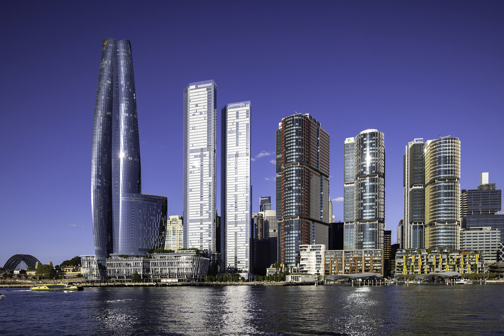
RSHP庆祝Barangaroo南区总体规划(Barangaroo South Masterplan)的竣工。该项目将悉尼中央商务区(CBD)西北侧海港从一处废弃的集装箱码头,转变为紧邻水岸的集商业、居住于一体、实现碳中和、充满活力且包容的综合街区。
RSHP celebrates the completion of the Barangaroo South Masterplan which has transformed The City of Sydney’s north-western harbour from a disused container port on the edge of the Central Business District (CBD) to a mixed-use, carbon neutral, vibrant, inclusive precinct sitting at the water’s edge.
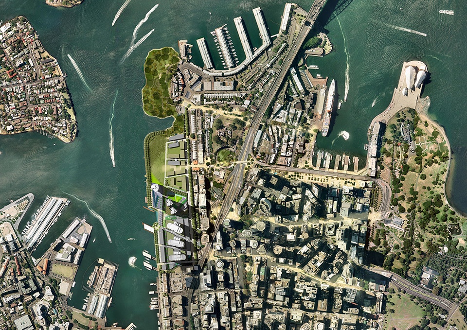
RSHP与Lendlease共同中标,占地22公顷的Barangaroo总体规划以设计竞赛的方式寻求开发商。总体被组织为三个彼此独立的片区:面向高密度商办与住宅开发、作为城市CBD延伸的Barangaroo South;以自然化方式重构历史北端岬角、面向全民开放的景观目的地Barangaroo Reserve;以及低密度住宅社区、面向海港城市公园并连接南北向的Barangaroo Central。
RSHP, with Lendlease, won a design competition that sought a developer for the 22-hectare Barangaroo masterplan. The masterplan was organised into three distinct precincts: Barangaroo South for high density commercial and residential development, an extension of the city’s CBD; Barangaroo Reserve, a naturalistic reconstruction of the historic northern headland as a landscaped destination for all; and Barangaroo Central, a low density residential neighbourhood overlooking a harbour-side city park, and connecting North to South.
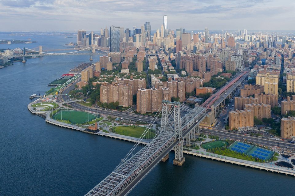
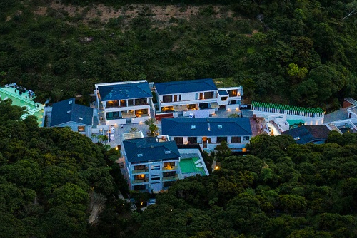
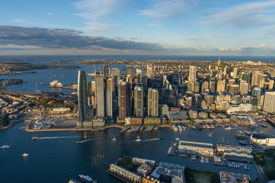
▼项目鸟瞰,aerial view of the project
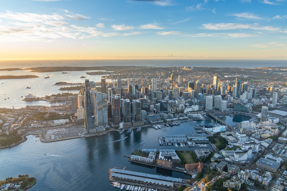
▼项目鸟瞰,aerial view of the project
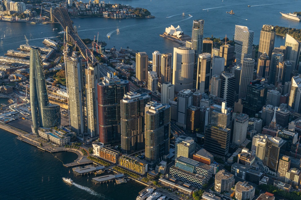
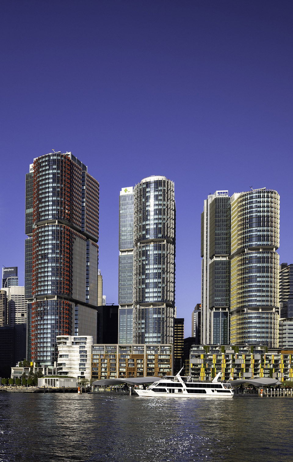
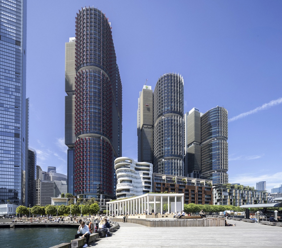
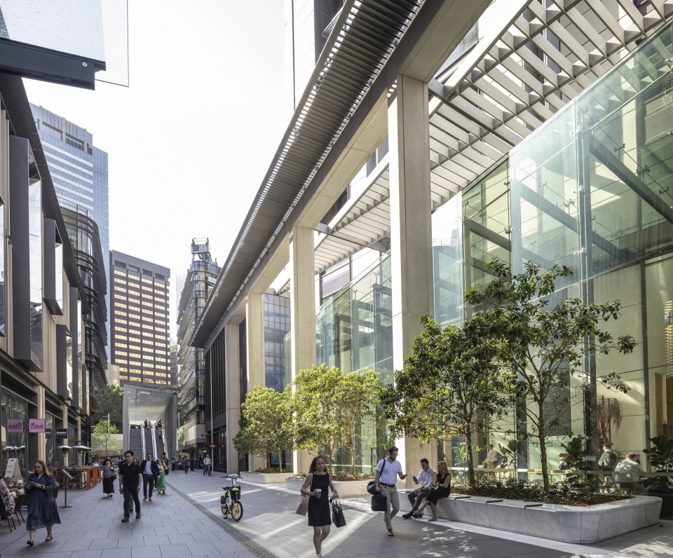
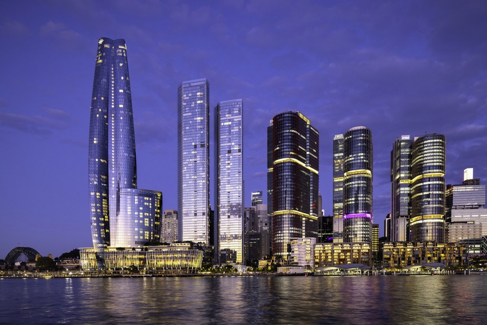
自首期开发完成后的十年间,Barangaroo South已成长为极为成功的新城区块,工作日与周末皆吸引悉尼市民、游客、上班族与居民。作为整个方案的核心,同时为更大范围公共空间提供资金支持的是 悉尼国际塔群(International Towers Sydney,2017)——三座“姊妹”办公塔以扇形网格布置,自街区与Wynyard主干线火车站(Wynyard Station)的联通点向外辐射。塔楼在尺度与密度上承接CBD,并向西敞开,在街道层面为全可达的滨水空间留出余地、并“民主化”了水岸景观视野。
▼设计策略,design strategy
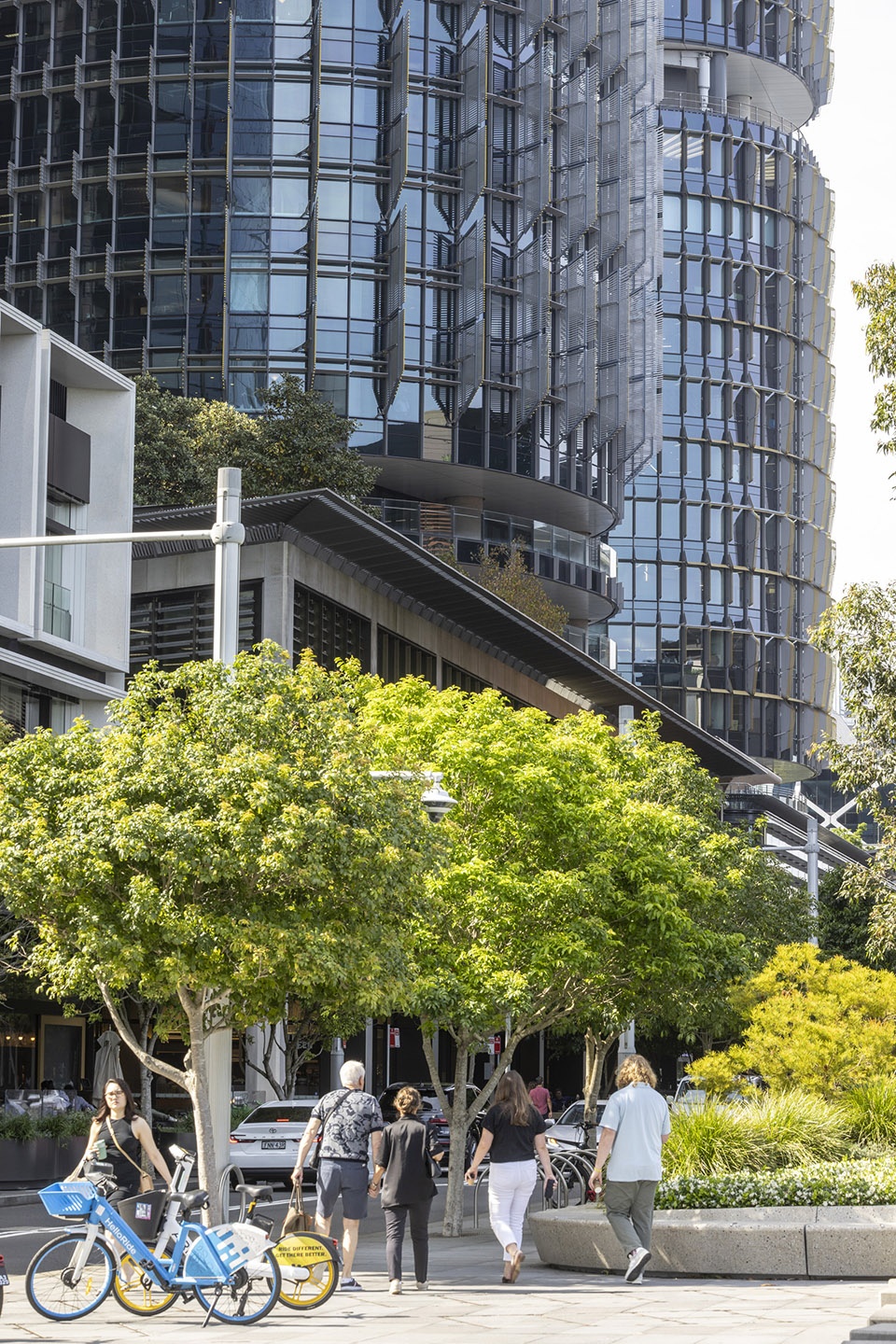
In the 10 years since the completion of the first phase of the development, Barangaroo South has become an extraordinary successful new city quarter frequented by Sydneysiders, tourists, workers and resident’s alike, seven days a week. At the heart of the scheme and generating the finance for the public spaces across the wider masterplan area, are the International Towers Sydney, (2017), three ‘sibling’ office buildings organised on a fan-shaped grid radiating from the precinct’s connection to Wynyard Main Rail Station. The towers adopt the scale and density of the CBD and open out towards the west, democratising views whilst making space at street level for the fully accessible waterfront.
▼水岸景观视野,street level for the fully accessible waterfront
▼水岸景观视野,street level for the fully accessible waterfront
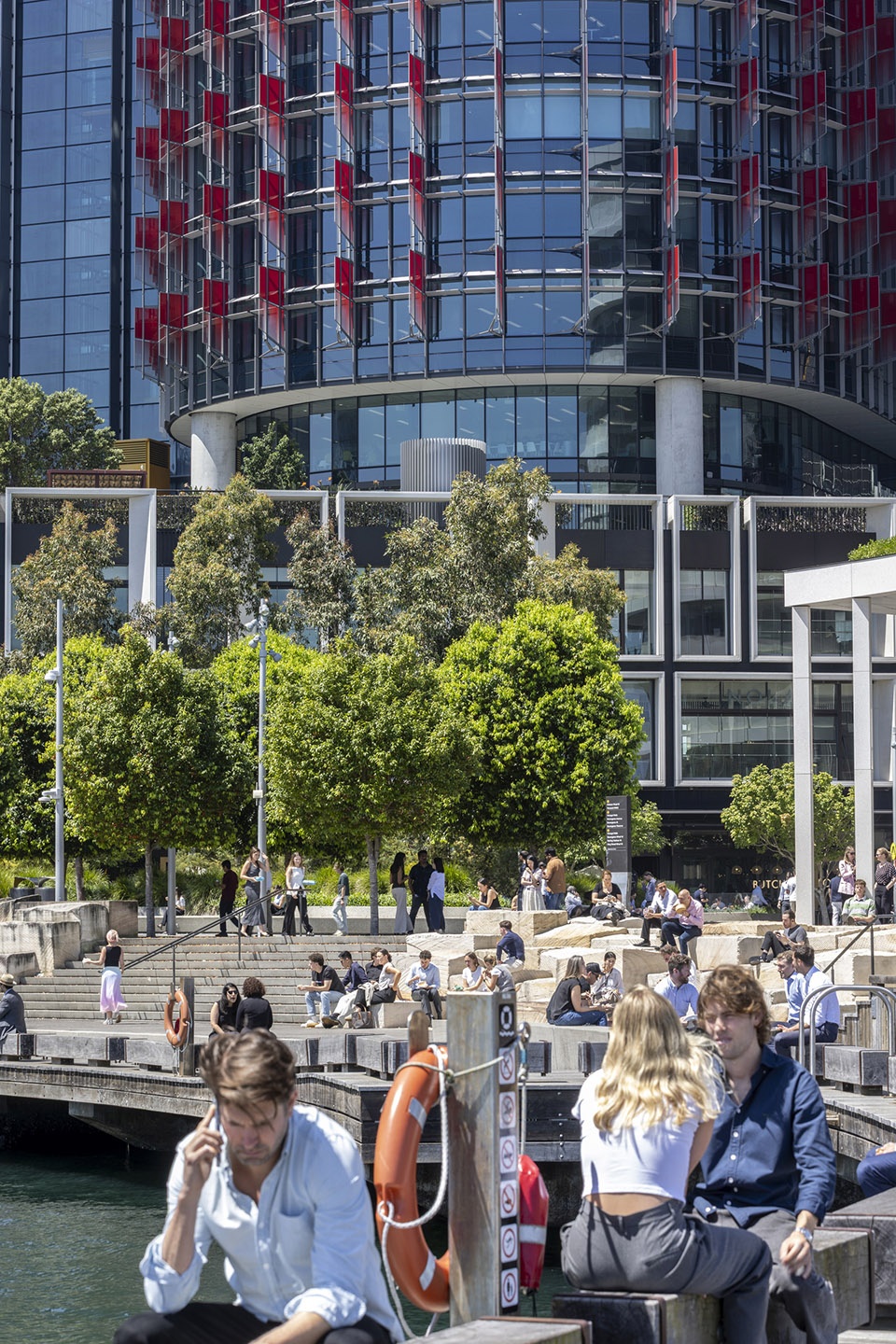
超过三分之二的用地被划为公共与休闲空间,包括一条此前被港口割裂、如今连绵成线的连续滨水步道Wulugul Walk(2021);以阶梯式木栈道通向水面的露天剧场空间Watermans Cove(2025);以及一处为社区提供绿色休憩的一公顷公园 Hickson Park(2020)。
▼模型,model
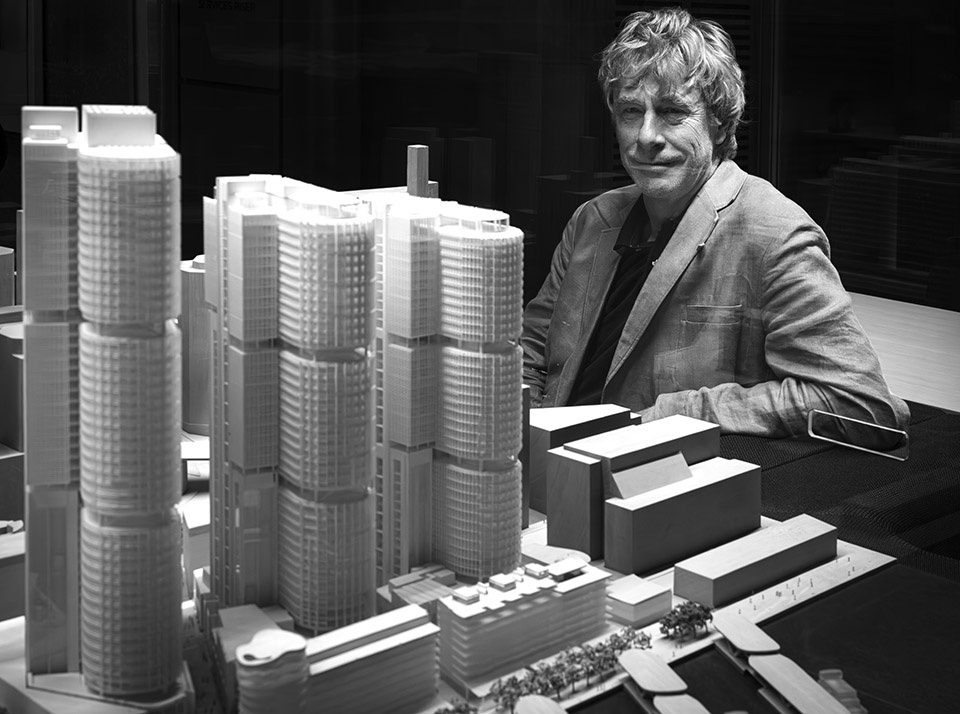
Over two-thirds of the land area was set aside as public and recreational spaces, including a continuous waterfront promenade that was previously broken by the port, (Wulugul Walk, 2021); an amphitheatre-style boardwalk stepping down to the water, (Watermans Cove, 2025) and a one-hectare park, providing a green retreat for the community, (Hickson Park, 2020).
▼连绵成线的连续滨水步道,a continuous waterfront promenade
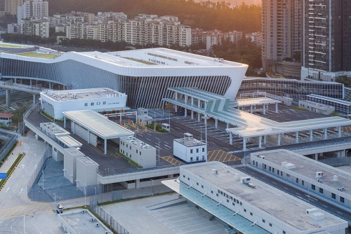
总体规划通过强化步行与公共交通联系,将片区重新织补进悉尼城市肌理:包括将Wynyard车站“带到”Barangaroo 门口的Wynyard Walk与Sussex Street Bridge(2016);新的Barangaroo Ferry Wharf(2017);以及位于Barangaroo Central的 悉尼地铁Barangaroo 站(2024)。现有岸线被重新构想为城市级连续14公里滨水步行系统的一部分(西起Anzac Bridge、东至皇家植物园),把人们更贴近水面,在更宽的滨水大道上创造亲密与联结的片段——成为聚会、沉思与庆祝悉尼海港身份的场所。
The plan reconnects the area with the rest of Sydney by creating strong pedestrian and public transport links, including Wynyard Walk – which brings Wynyard Station to the doorstep of Barangaroo – and Sussex Street Bridge (2016); a new ferry terminal (Barangaroo Ferry Wharf (2017), and a metro station (Sydney Metro Barangaroo Station, 2024) at Barangaroo Central.The existing shoreline was reimagined as part of a citywide vision for continuous 14km waterside walk between Anzac Bridge to the west and the Botanic gardens to the east. The design brings people closer to the water, creating moments of intimacy and connection along the broader waterfront promenade — a place for gathering, reflection, and celebration of Sydney’s harbour identity.
▼滨水步行系统,continuous 14km waterside walk
可持续性Sustainability
Barangaroo参与克林顿气候倡议(CCI) 的“气候正向开发计划”,堪称可持续、气候响应型城市设计的范例。Barangaroo South于2019年成为澳大利亚首个实现碳中和的片区。片区及悉尼国际塔群均获得WELL白金级认证,使其成为全球最可持续的多功能综合片区之一;同时三座塔楼均获 澳大利亚绿色建筑委员会Green Star 6星级(建筑可持续性的最高等级)。总体规划鼓励步行、骑行与公共交通,补齐悉尼连续滨水长廊,并成为串联海港沿线重要公共节点的“文化之路”一部分。
▼构成爆炸图,key components
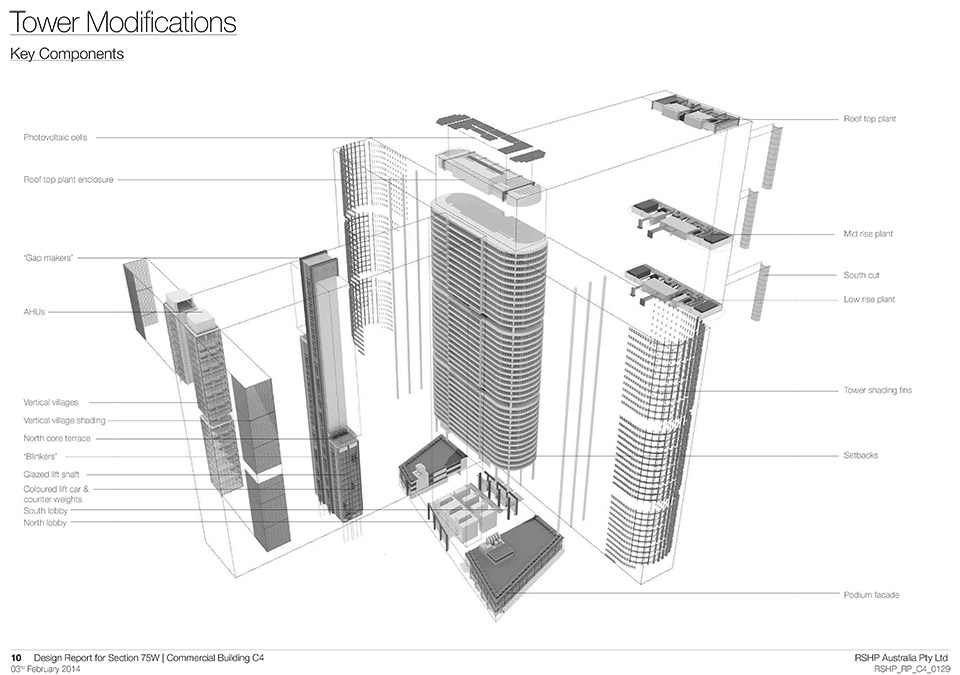
Barangaroo is part of the Clinton Climate Initiative’s Climate Positive Development Program, and represents an exemplar of sustainable, climate-responsive urban design. Barangaroo South became Australia’s first carbon-neutral precinct in 2019. The area, as well as the International Towers have all been WELL Certified at the Platinum level – making it one of the world’s most sustainable multi-use precincts. In addition the towers have all been recognized with a 6 Star Green Star rating – the highest level of sustainability for a building – from the Green Building Council of Australia.The masterplan encourages walking, cycling, and public transport, completing Sydney’s continuous waterfront promenade and forming part of a ‘culture trail’ linking key civic destinations along the harbour.
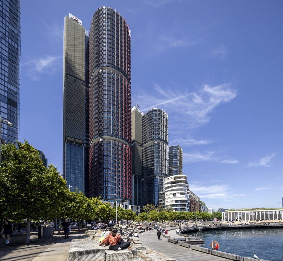
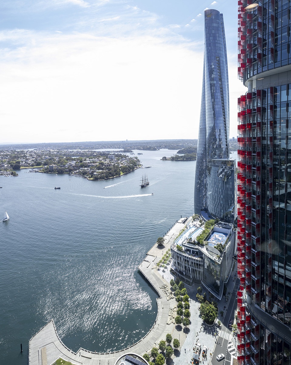
▼从塔楼鸟瞰滨水步道,look towards the waterfront promenade from the tower
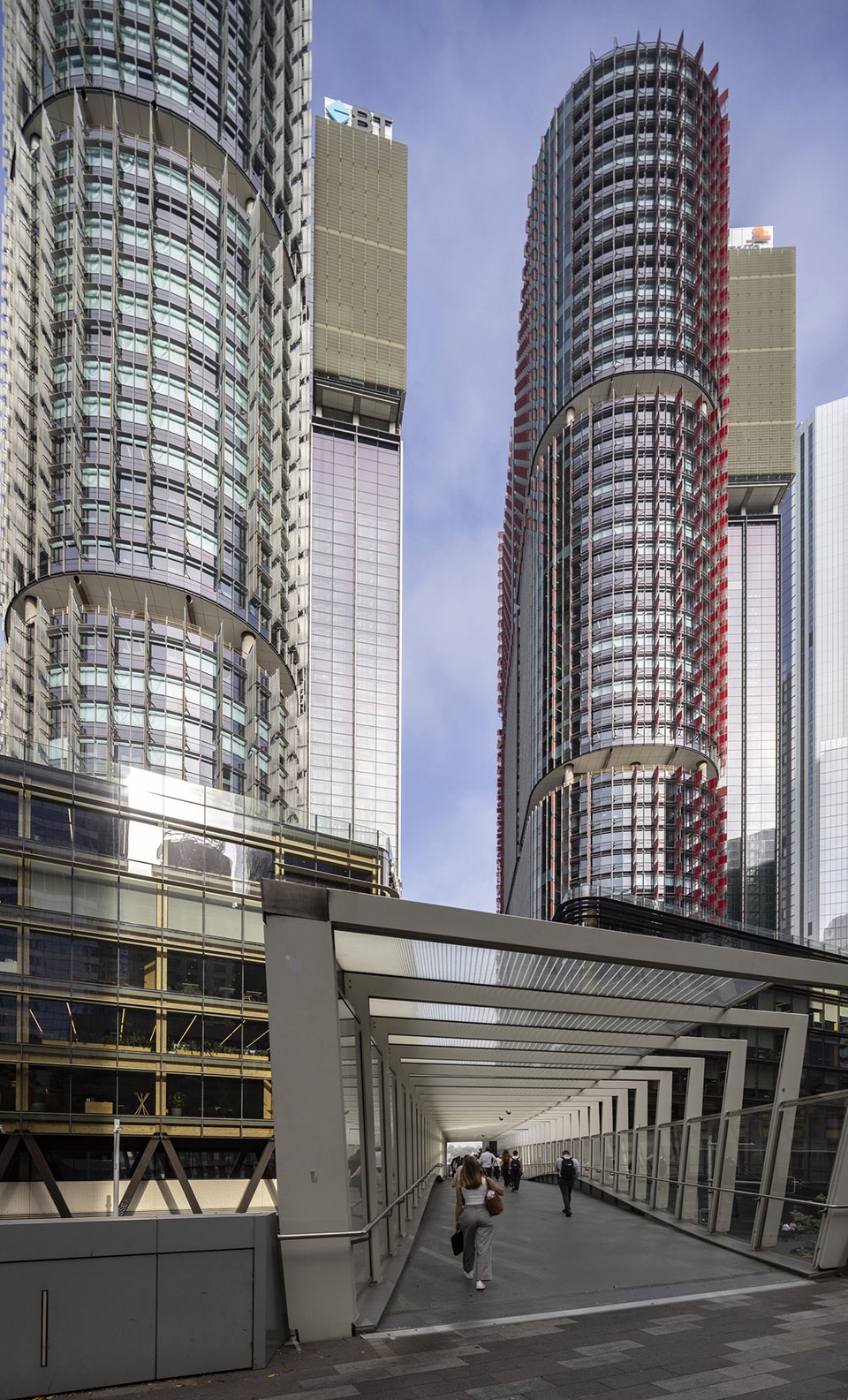
▼人行桥,walk pedestrian bridge
▼从码头望向塔楼,look towards the tower from the dock
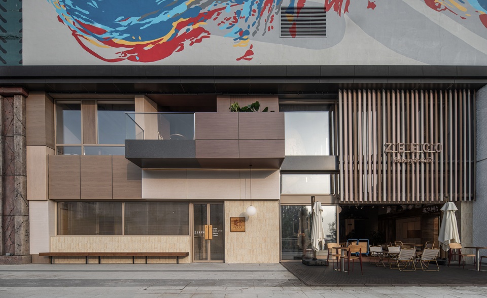
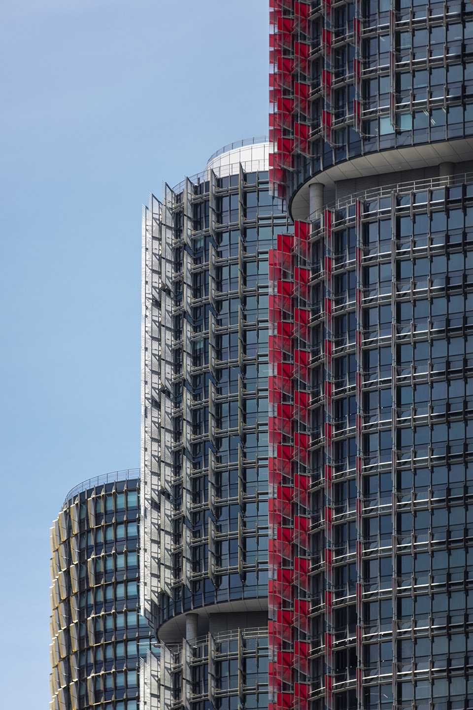
▼塔楼立面,the tower facade
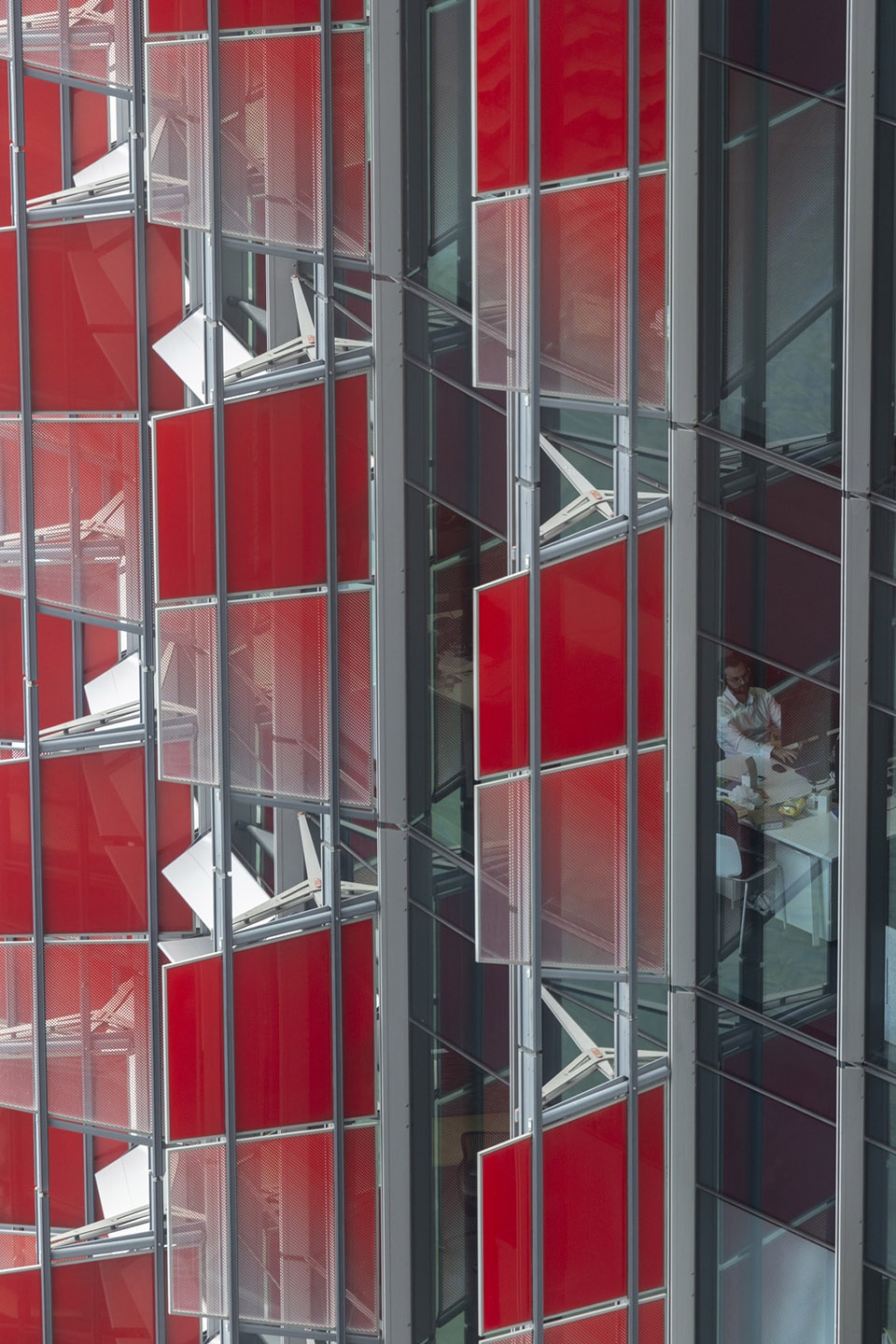
▼塔楼立面细部,the tower facade detail
引述Quotes
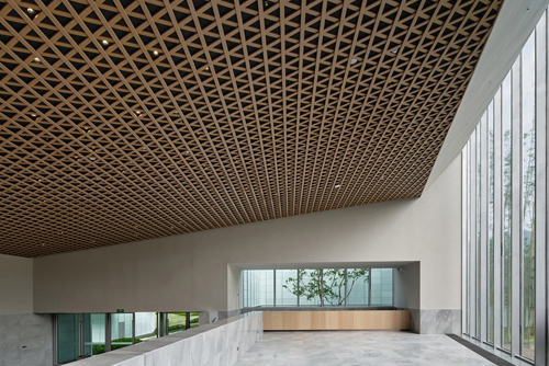
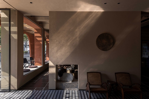
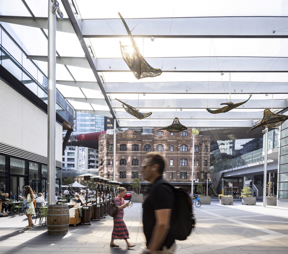
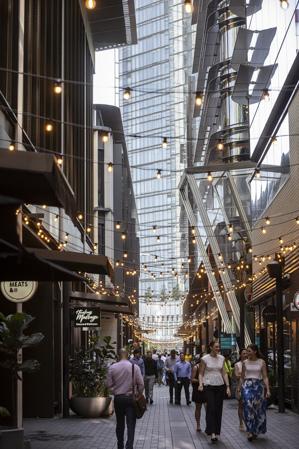
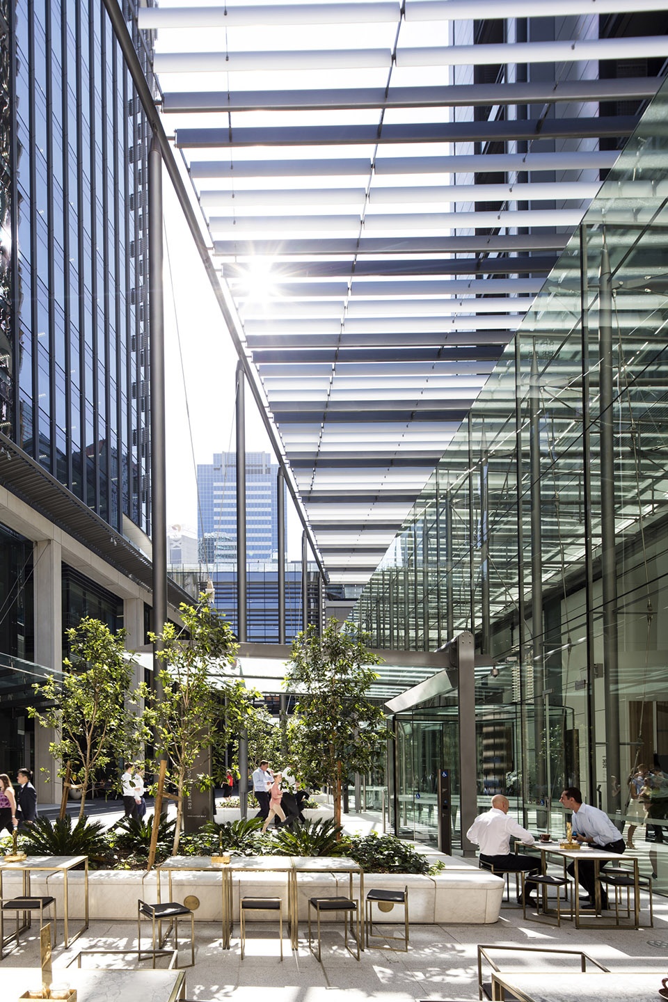
▼一层空间,ground floor space
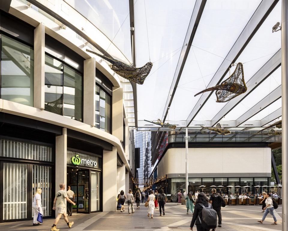
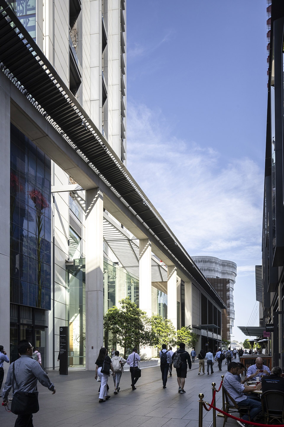
▼建筑群街景,the street view of the buildings complex
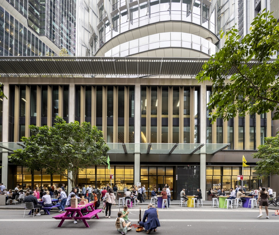
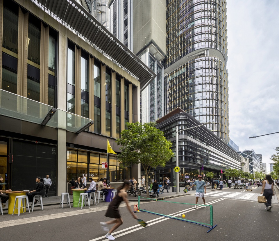
▼建筑群街景,the street view of the buildings complex
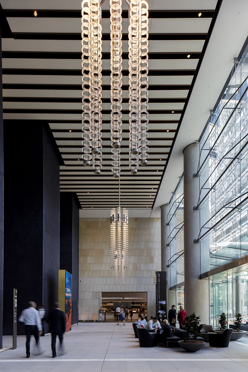
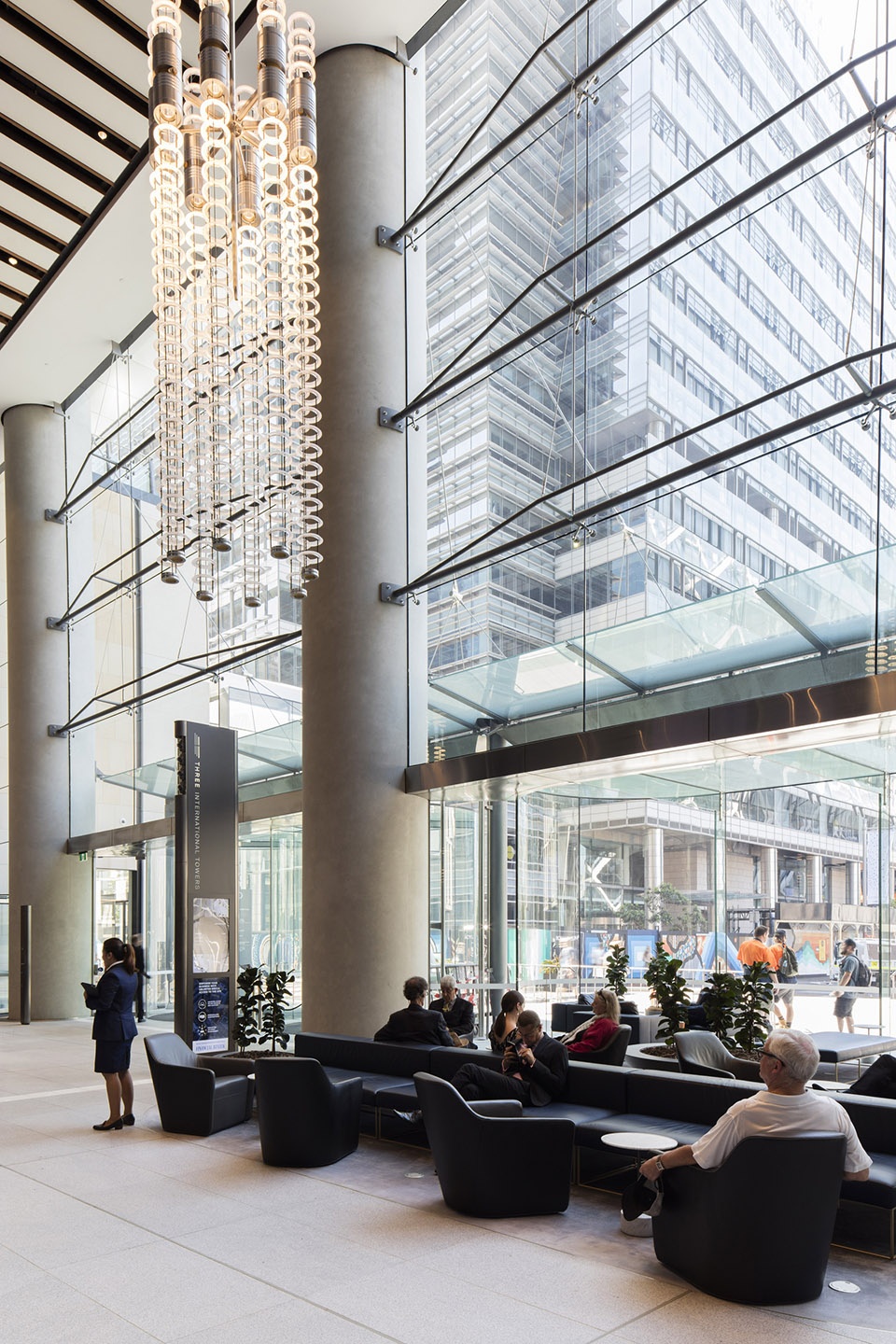
▼入口大堂,the lobby on the ground floor
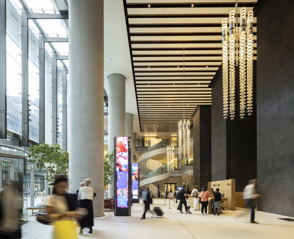
▼入口大堂,the lobby on the ground floor
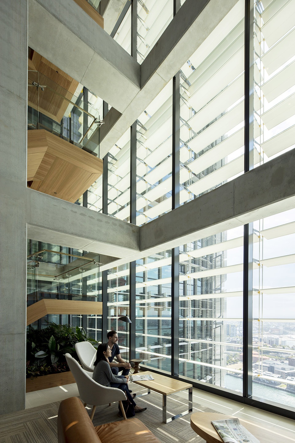
▼办公层空间,the office level space
▼中庭空间,atrium space
▼夜景,night view
▼场地平面,site plan
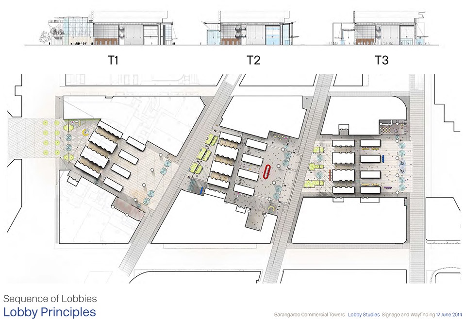
▼塔楼群大堂平面,sequence of lobbies
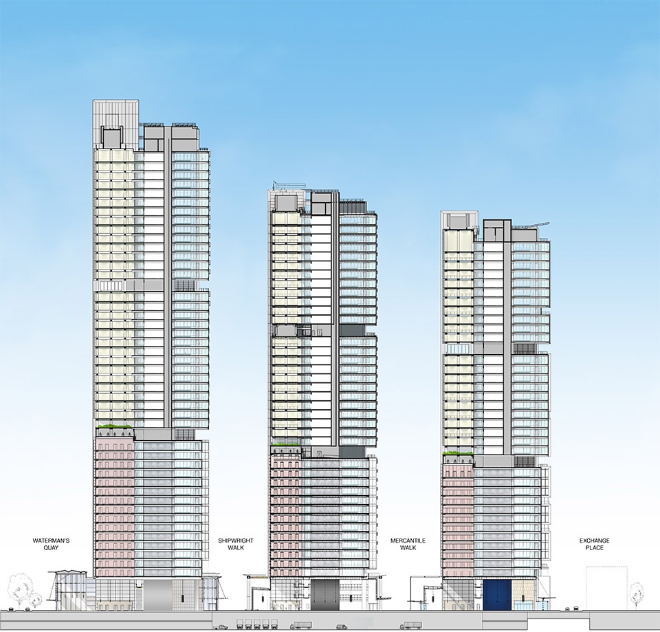
▼塔楼群剖面,towers section
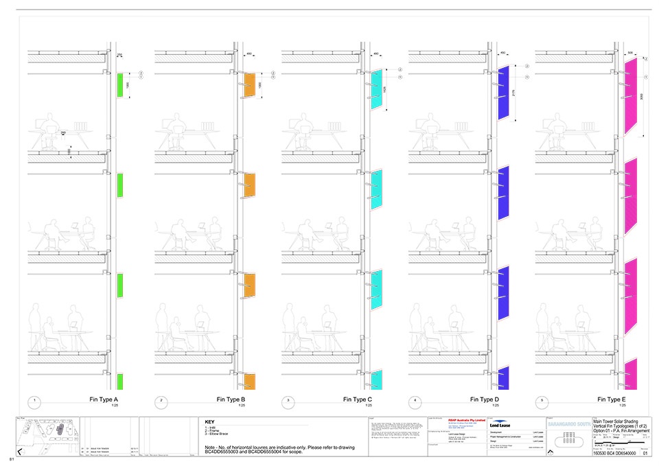
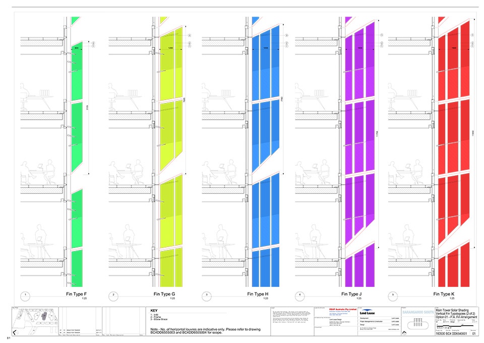
▼主塔遮阳垂直百叶类型,Main Tower Solar Shading Vertical Fin Typologies